
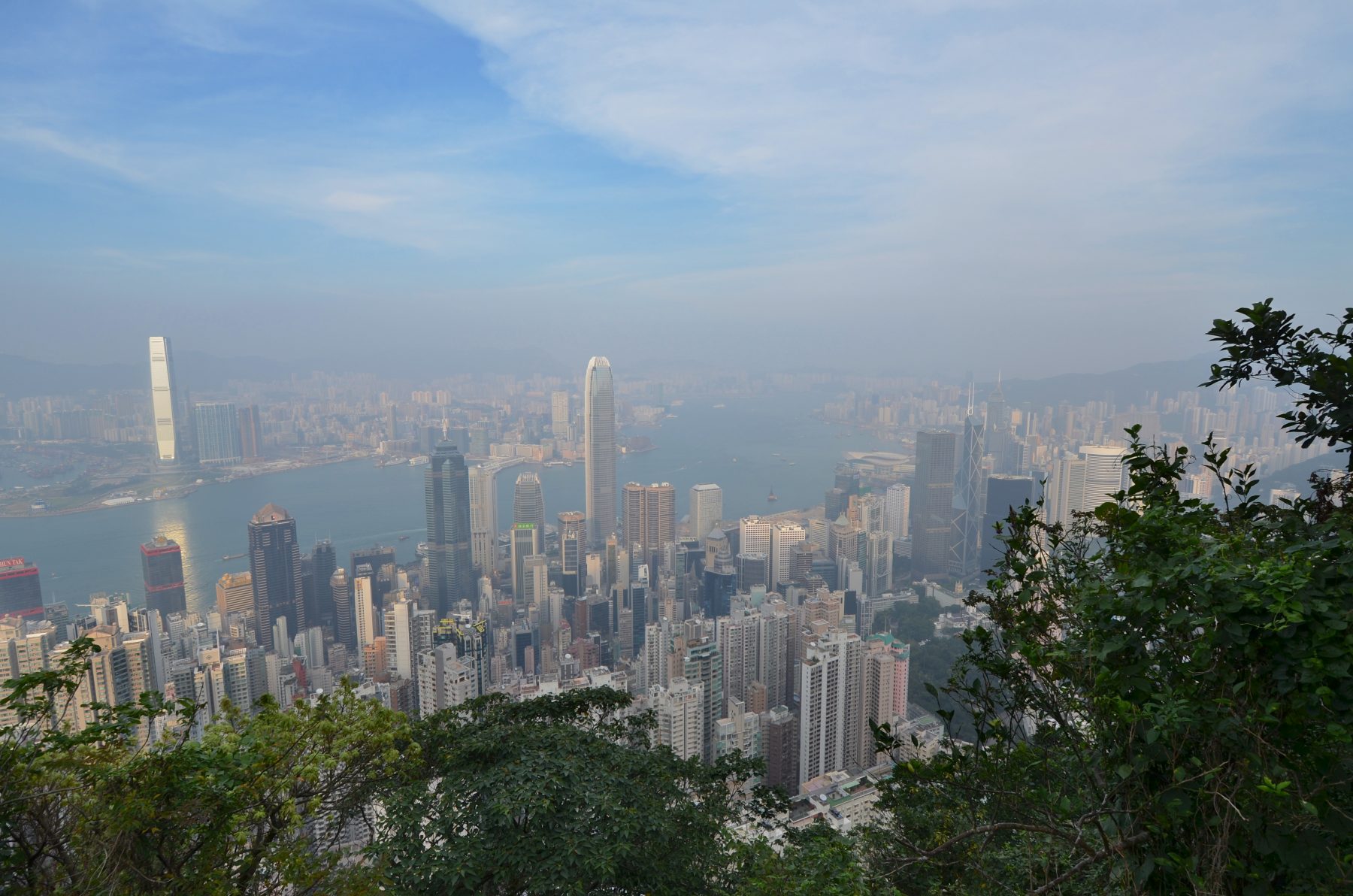
Victoria Peak

There’s nothing more satisfying than hiking up to The Peak and taking in the views over Hong Kong first thing in the morning. There are multiple routes to the top, but the 2.8km Morning Trail is a paved, easy-to-follow favourite that’s clearly marked, making it impossible to get lost.
How to get there: Take Central’s Mid-levels Escalators to Conduit Road, then turn right and walk for about 10 minutes before walking up Hatton Road on your left.
Dragon’s Back, Shek O

This is one of Hong Kong’s easiest and most popular hikes, with stunning views and a gentle rolling incline. The highest point is less than 300 metres, and there are panoramic views of the peninsula’s coastline at Shek O Peak. The Dragon’s Back viewing point offers views of Tai Tam Bay and Lamma Island on a good day, and if you’re lucky, you’ll see kite jumpers gliding through the air over the trail. The hike ends at Big Wave Way, a simple, pretty beach that’s popular with surfers.
How to get there: From Exit A3 at the Shau Kei Wan MTR station, take Bus 9 to Shek O. Alight at the To Tei Wan, Dragon’s Back stop, and follow the signs.
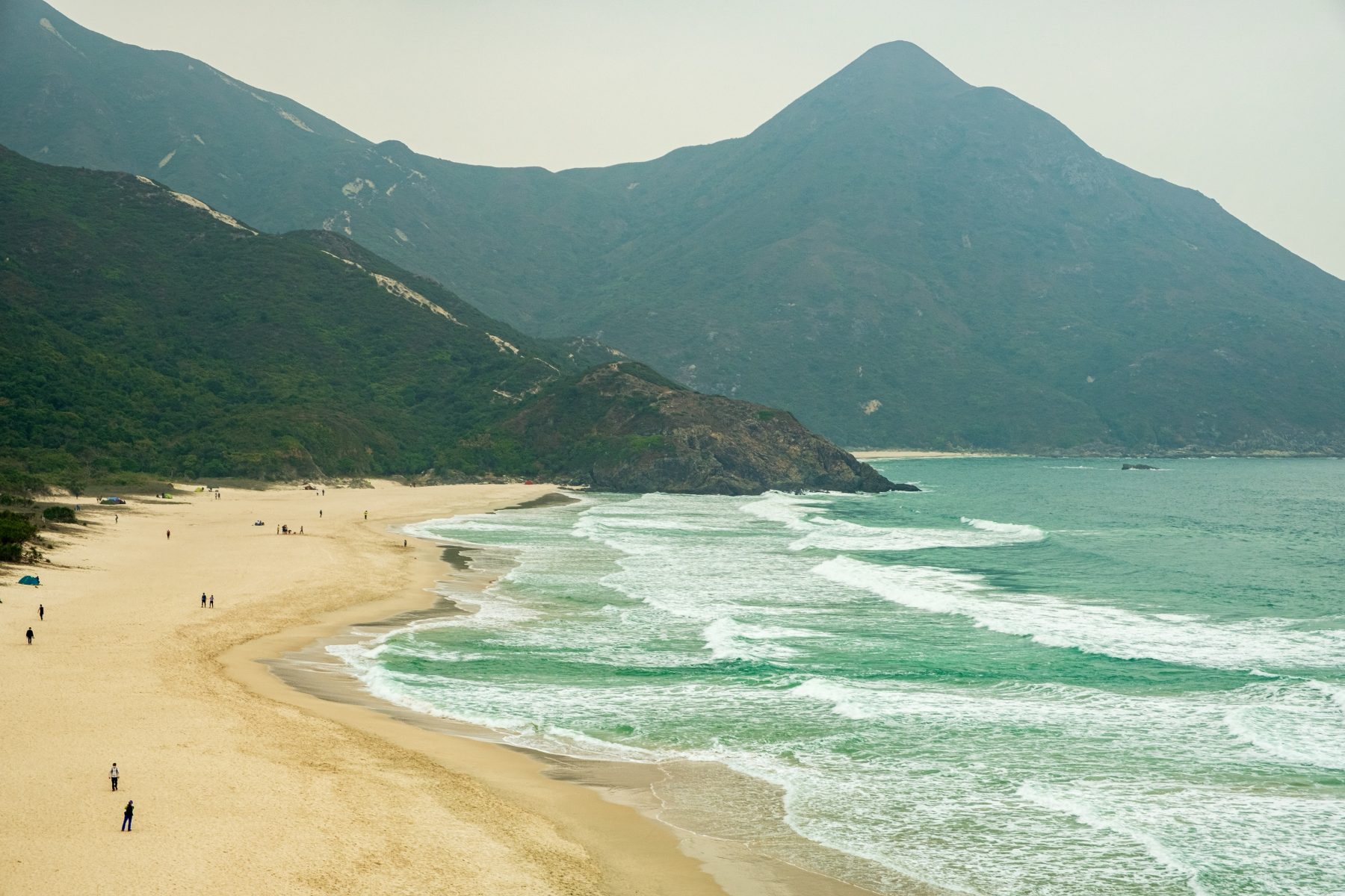
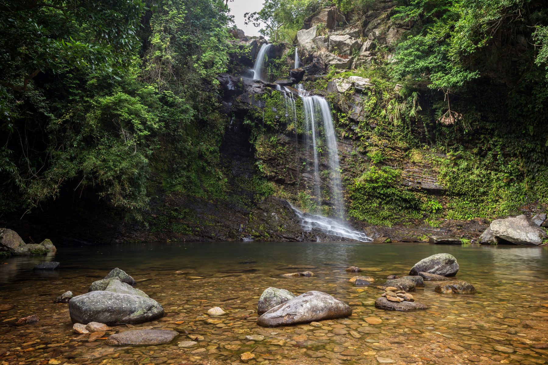
Tai Long Wan, Sai Kung

Hidden waterfalls, frozen pineapple snacks and a stunning beach are a few reasons why Tai Long Wan bay is such a popular weekend spot. The trail will take about 40 minutes to complete, featuring scenic viewpoints, ending at the beach where you can relax or explore a little further to reach the rock pools and waterfalls.
How to get there: From the Sai Kung Public Pier, take the 20R minibus to Sai Wan Pavilion in Sai Kung Country Park.
The Twins Peak

Some dread these famous twins, but completing them is always extremely satisfying and the views of Stanley worth it. The trail begins with a climb over Violet Hill before the real work begins with 1,000 gruelling steps. After you complete one large and one small mountain you’re rewarded with a breathtaking scene overlooking Hong Kong’s Southside.
How to get there: Take the 6, 41A, 76, 63, or 66 bus to Wong Nai Chung Reservoir Park. Look for the Sinopec gas station, then take the stairs that lead up to Tai Tam Reservoir Road to Parkview. Enter the entrance that shows the path towards Tai Tam Country Park.
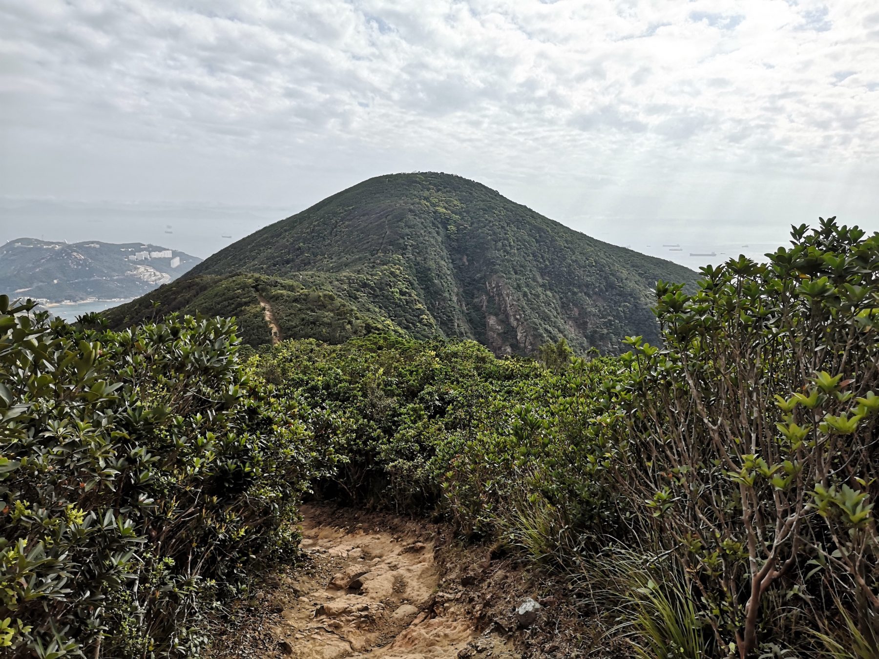
Lion Rock, Shatin

This history-steeped trail has its own mischievous monkey colony that cheekily steals food and trinkets from unsuspecting hikers. The views from the very top of the lion’s head are breathtaking, and you can see Hong Kong Island, Dragon’s Back, and Lantau Island on a clear day, making it worth the initial steep start.
How to get there: From Exit E of the Wong Tai Sin MTR Station, take the 18M green minibus to Shatin Pass Estate. Find the Fat Jong Temple across the road, and continue on Shatin Pass Road for around 20 minutes until you reach the Lion Rock Country Park entrance.
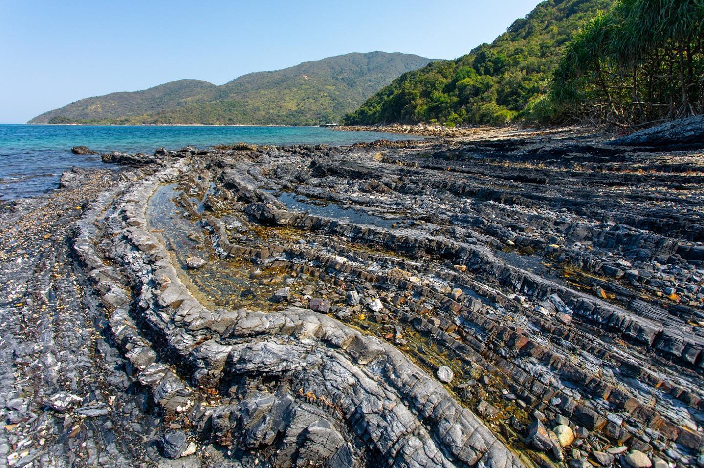
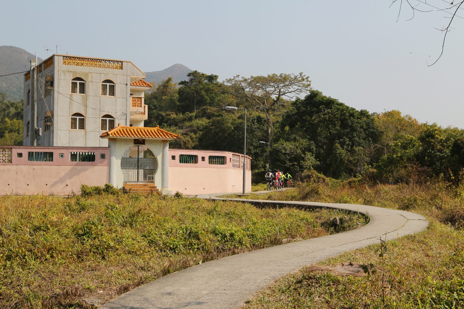
Lai Chi Chong Trail, Sai Kung West Country Park

As part of Hong Kong’s UNESCO Geopark, Lai Chi Chong is famous for its fascinating volcaniclastic rock formations along the coastline, but the area is also home to the stunning Lai Chi Chong hiking trail. The 3.5 km trail also features spectacular views of the rustic Pak Sha O village and will lead you to the sea, where the gentle ocean breeze will surely cool you off after the excursion. Should you wish to explore the area further, take some time after the hike to navigate the shorelines, where you’ll find attractions like the Giant’s Washboard.
How to get there: From the Sai Kung Public Pier, take the 7 minibus going in the Hoi Ha direction, alighting at the Pak Sha O Youth Hostel stop. Follow the signs that say Lai Chi Chong to get to the start of the trail.
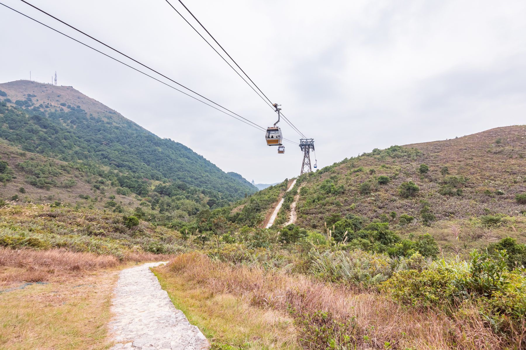
Ngong Ping 360 Rescue Trail, Lantau Island

The Big Buddha is a noteworthy attraction that can easily be accessed via buses and cable cars. But try to take the road less travelled, which makes for a more memorable experience. Initially built for cable car maintenance and emergencies, the Ngong Ping 360 rescue trail nowadays is also open to the public. Parts of the 5.6km trail are paved with wooden planks that ensure a safe–but strenuous–climb, and at the end, you’ll be rewarded with a grand view of the Big Buddha himself.
How to get there: From Exit A of the Tung Chung MTR station, walk past Yat Tung Estate to get to the Tung O Ancient Trail. Walk around 10 minutes, and find the start of the Ngong Ping 360 Rescue Trail on your left.
Bride’s Pool Nature Trail, Plover Cove Country Park

Photo: Tuomas A. Lehtinen/Moment Open via Getty Images
Hong Kong’s incoming summer heat waves are no joke, but take a reprieve from those deadly rays for a hike at Bride’s Pool Trail. The 860km looped trail features towering trees and the calming sound of babbling brooks that will stave off the worst of the heat. We recommend a 700m detour from the trail that will lead you to breathtaking views of the Mirror Pool and Bride’s Pool waterfalls, making for lovely Instagram photos.
How to get there: From the Tai Po Market MTR station, take the 20R green minibus outside the station to the Bride’s Pool Terminus bus stop. Alternatively, go on a Sunday for the 275R bus that arrives at 15-20 minute intervals.
Wu Kau Tang Country Trail, Plover Cove Country Park

For a leisurely hike in the summer, we recommend spending an afternoon on the Wu Kau Tang Country trail. The easy 2.6km hike features vibrant woodlands and ample covering that ward off the summer heat. You may even catch glimpses of Hakka architecture along the way, hidden gems that remain integral to Hong Kong’s cultural history. Dog owners are welcome to bring along their furry companions, as this trail is pet-friendly, with some areas that allow your pets to run off-leash.
How to get there: From Exit B of the Tai Po Market MTR station, take the 20R minibus to the Wu Kau Tang Tsuen stop.
Tai Mo Shan Hiking Trail

Photo: Joe Chen Photography/Moment via Getty Images
For those up for a challenge, a trek through Tai Mo Shan is a must for your bucket list. Boasting a staggering elevation of 957m, Tai Mo Shan (“Big Hat Mountain”) is the city’s highest peak. There are several hiking trails available on the mountain, but those willing to go the extra mile should try the Tai Mo Shan-Needle Hill-Grassy Hill-Lead Mine Pass trail, whose 17.2km length can literally take your breath away. Prospective hikers should note that it’s best to go on cloudier days, as parts of the trail offer little to no shade.
How to get there: From Exit B1 of the Tsuen Wan MTR station, walk to Shiu Wo Street, take the 82 green minibus, and alight at the Shing Mun Reservoir stop.
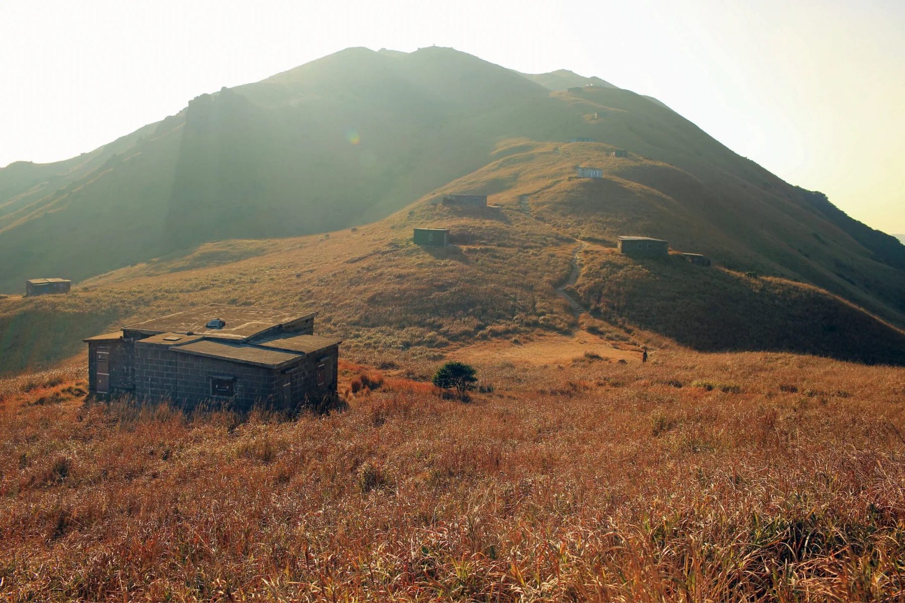
High Island Geo Trail
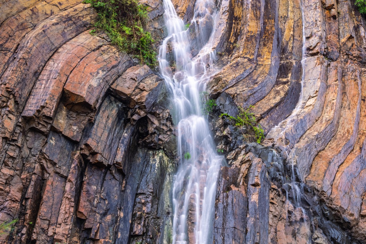
140 million years ago, a supervolcano erupted in what is known as Sai Kung today, eventually creating hexagonal rock columns that characterise the geological heritage site. Comprising the East Dam section and the Biu Tsim Kok section, the High Island Geo Trail allows hikers to see these rock formations from a close distance, and get a full view of the reservoir and coastal vistas. Its abundance of natural wonder makes this one of the most popular trails in Hong Kong!
How to get there: Take bus no. 94 departing from Sai Kung Town Centre, bus no. 96R departing from Diamond Hill MTR station or bus no. 289R departing from Sha Tin Central, get off at Pak Tam Chung and take green minibus no. 9A to the East Dam of High Island Reservoir (weekends and public holidays only).
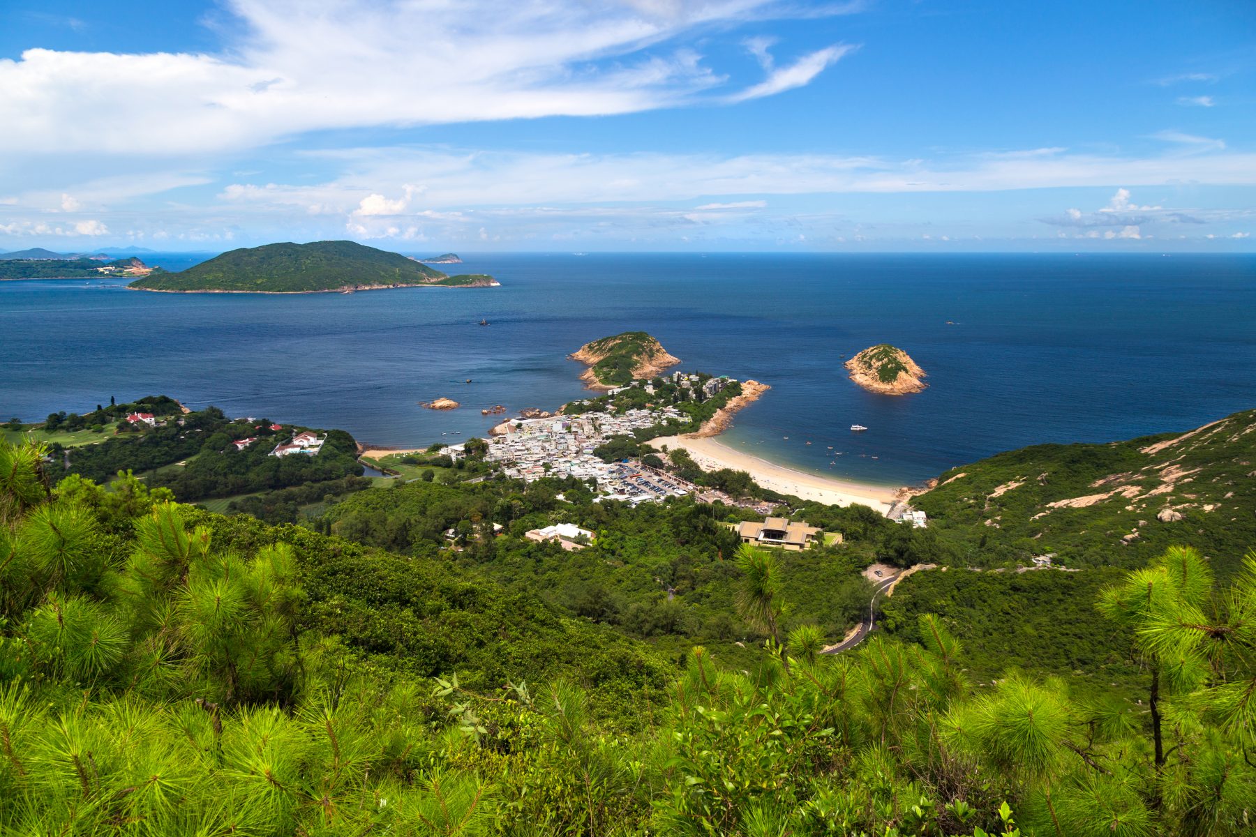
Sunset Peak

Boasting 869 meters in height, Sunset Peak is the third highest peak in Hong Kong. On the open grassy hillside, you’ll find silvergrass swaying in the wind and stone huts dotted along the path. To reach the peak, there are multiple trails one can take: through Pak Kung Au is the shortest and steepest in steps, while the Lantau Trail Section 2 route is longer but with a more gradual incline. Though challenging, this hike promises a rewarding view of Hong Kong’s longest beach, ferries zipping between Hong Kong and Macau, and the Soko Islands in the distance.
How to get there: For the Pak Kung Au route, head to MTR Tung Chung Station Exit B, take bus 3M, 11, 11A or 23 at the Tung Chung Station Bus Terminus and alight at Pak Kung Au where the Lantau Trail begins. For the Lantau Trail Section 2 route, take bus 1, 2, 3M, or 4 from Mui Wo Ferry Pier to Nam Shan Sam Uk Tsuen.
Reservoir Islands Viewpoint
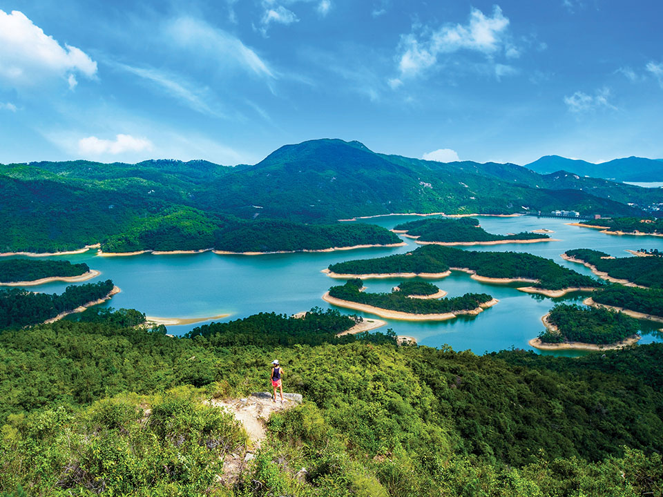
Otherwise known as Thousand Island Lake, this spot got its name from the scenic islands dotted along the reservoir. In fact, they were peaks of hills before the open valley was flooded to create the breathtaking spectacle we see today. To its right are views of Tuen Mun and the airport a little further. Fortunately, the path to this viewpoint is mainly shaded, flat and paved, so you will still be looking fresh for your Instagram photos. Keep in mind that it gets quite crowded during weekends with hikers trying to get the perfect shot!
How to get there: Take minibus 43 or 43S from Tuen Mun Station and alight at So Kwun Wat Tsuen. To leave, take bus K66 to return to Yuen Long town or Long Ping Station.

Editor
Dervla Louli, Mina Chan and Karrie LamCredit
Lead image: Martin Williams/South China Morning Post via Getty Images